Valdez
Above 4,000ftConsiderable
2,000 to 4,000ftConsiderable
Below 2,000ftConsiderable
Degrees of Avalanche Danger
Avalanche Problems
Problem 1
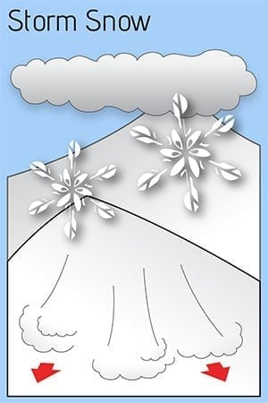
The avalanche hazard will be rapidly increasing through the weekend. Thompson Pass has received 15 inches of snow in the last 24 hours bringing the total snowfall since the 8th to 30 inches. Significant moisture is forecasted to continue to pump into our area with an additional 24-30 inches expected by Monday morning. Temperatures are expected to rise, peaking Sunday bringing snow lines to 3000 feet. This rise in temperatures will create top heavy storm slabs up to 3 feet in depth. Human triggered avalanches will be likely and natural avalanches possible. Our thin early season snowpack will need time to adjust to this storms added weight. In the meantime expect to find widespread areas of unstable snow.
Likelihood:
- Almost Certain
- Very Likely
- Likely
- Possible
- Unlikely
Size:
- Historic
- Very Large
- Large
- Small
Trend
- Increasing
- Steady
- Decreasing
Weather
DATE               SATURDAY 11/12/22       SUNDAY 11/13/22
TIME (LT)          06    12    18    00    06    12    18    00    06
CLOUD COVER        OV    OV    OV    OV    OV    OV    OV    OV    OV
CLOUD COVER (%)   100   100    90    90   100   100   100    95    95
TEMPERATURE        31    32    32    30    29    33    36    33    32
MAX/MIN TEMP                   33          28          36          30
WIND DIR           SE    SE     S     S    SE    SE     S     S    SW
WIND (MPH)         18    17    12    12    16    25    18     8     9
WIND GUST (MPH)
PRECIP PROB (%)   100   100    90    90   100   100   100    90    80
PRECIP TYPE         S     S     S     S     S     S     S     S     S
12 HOUR QPF                  0.70        0.43        1.10        0.62
12 HOUR SNOW                  5.5         4.0         6.4         3.2
SNOW LEVEL (KFT)  1.8   2.1   1.8   1.5   1.6   2.3   2.6   1.9   1.2
Additional Information
Our snow season began with above average precipitation and temperatures. Beginning in September, snow lines generally hung around 4500′ until 10/12. At that point our area received the first snow down to sea level with 12-16 inches on the north side of Thompson Pass.
On 10/15 wet conditions continued with the freezing line rising to 5000′ or higher. As skies finally cleared on 10/22 we were left with a thin rain saturated snowpack capped by a stout rain crust up to 4500′. Above 4500′ much deeper snowpacks existed due to significant early season snowfall at upper elevations.
Dry and cold conditions along with moderate outflow winds finished out the month of October.
On 11/1 precipitation returned with 18 inches of snow and ~1″ of SWE on Thompson Pass. This new snow was initially reactive with several natural D2 avalanches reported on Thompson Pass. These slides were running on a firm bed surface consisting of old rain crusts and old wind slabs from October.
On 11/4 a strong north wind event kicked up with 65 mph+ winds on Thompson Pass. Our snowpack received significant damage as already thin snow below 4500′ was stripped down to old wind slabs, rain crusts and the ground.
Precipitation returned on 11/8 and became heavy on 11/11. 30 inches of snow has been recorded at Thompson Pass DOT. An additional 24-30 inches is expected by Monday morning.
Announcements
The avalanche hazard is CONSIDERABLE. Human triggered avalanches up to 3 feet in depth will be likely and natural avalanches are possible. Expect to find widespread areas of unstable snow through the weekend as our thin, early season snowpack adjusts to the weight of significant new snow.
Click the (Full forecast +) button below for additional information. Consistent avalanche forecasts will begin December 1st.
