![]()


Ways to support your local non-profit avalanche center:
- Become a Valdez Avalanche Center Member
- Advertise your local business as a Community Partner
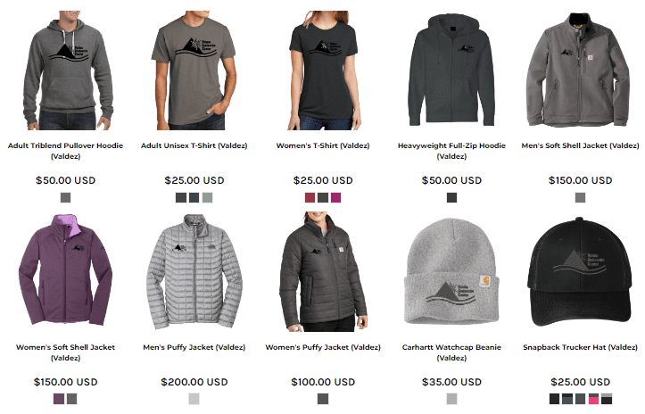
- Purchase apparel and gears that gives back at the Webstore
- Contribute through a tax-deductible Donation
-
 on your 2025 Alaska PFD