Valdez
Above 4,000ftHigh
2,000 to 4,000ftHigh
Below 2,000ftConsiderable
Degrees of Avalanche Danger
Avalanche Problems
Problem 1
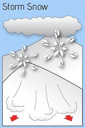
Continued snowfall has been steadily building storm slabs since 11/25, with Thompson Pass receiving over 4 feet of snow combined with moderate wind. Rising temperatures and significant additional snow/rain will cause the upper section of the snowpack to become top heavy (upside down). This will make human triggered storm slabs up to 3+ feet deep very likely on slopes steeper than 35°. Natural avalanches in the upper snowpack are likely 12/2.
Likelihood:
- Almost Certain
- Very Likely
- Likely
- Possible
- Unlikely
Size:
- Historic
- Very Large
- Large
- Small
Trend
- Increasing
- Steady
- Decreasing
Problem 2
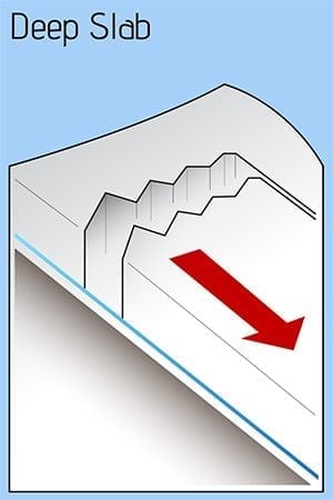
Weak Basal facets exist at the ground which have shown propagation energy in stability tests. These layers may be overcome by ~ 2 of SWE and rising temperatures that occurred 12/1. An additional 1″ of SWE forecasted 12/2 will continue to stress these weak layers. Full depth natural avalanches will be possible 12/2.
Likelihood:
- Almost Certain
- Very Likely
- Likely
- Possible
- Unlikely
Size:
- Historic
- Very Large
- Large
- Small
Trend
- Increasing
- Steady
- Decreasing
Avalanche Activity
11/15: Natural avalanche observed in Loveland Basin on a South aspect, down the ridge from Tones Temple. This slide was triggered by recent NE wind loading and failed at the ground. SS-N-R1-D2-G
11/16: Natural avalanche observed on Billy Mitchell “Cry babys shoulder”. Released from~3500′ with a crown length of ~200 meters, North aspect. This slide was triggered by recent NE wind cross loading the slope. SS-N-R2-D2-U
11/29: Natural avalanche observed on Billy Mitchell Cry babys shoulder, similar elevation as 11/16 slide but originated a couple hundred meters further west. Released from ~4000′ with a crown length of ~ 200 meters, North aspect, ~ 37°, failed at the ground. HS-N-R2-D2.5-G

11/30- Natural avalanche observed on 40.5 mile peak just to the South of the Shovel. West aspect, ~4500′, crown ~200′ wide, poor light prevented further observation. SS-N-R1-D2-U.
Weather
12/2- A large low pressure system will continue to affect our area through 12/2. Temperatures are forecasted to rise and bring the freezing line up to 3000′ by late Tuesday before dropping back down to sea level Wednesday afternoon. An additional 1.1″ of SWE are forecasted for the next 24 hours.
The Thompson Pass Mountain Forecast covers the mountains (above
1000 ft) surrounding Keystone Canyon through Thompson Pass to
Worthington Glacier.

This forecast is for use in snow safety activities and emergency
management.

                   Today        Tonight

Temp at 1000`      42 F         29 F

Temp at 3000`      35 F         17-32 F

Chance of precip   100%         90%

Precip amount
(above 1000 FT)    0.62 in      0.49 in

Snow amount
(above 1000 FT)    0-2 in       3-6 in

Snow level         3000 ft      500 ft

Wind 3000` ridges  SE 15-25 mph   SW 10-18 mph

Remarks...None.
| Date: 12/2 | 24 hr snow (inches) | HN24W (snow water equivalent inches) | High Temp (F) | Low Temp (F) | Weekly SWE Inches (Monday-Sunday) | December snowfall | Season snowfall | HS (snowpack depth inches) |
| Valdez | 0 | 1.68 | 37 | 31 | 2.8 | 5 | 48 | 27 |
| Thompson Pass | N/O | N/O | 31 | 27 | N/O | N/O | N/O | N/O |
| 46 Mile | 0 | 1.03 | 39 | 33 | 1.95 | 9 | 38 | 16 |
Thompson Pass weather history 20/21. Click on links below the images to see full size view

Alerts
The avalanche hazard is HIGH. Avoid travel in or below avalanche terrain today. An additional 1″ of snow water equivalent along with rising temperatures and strong winds will create widespread areas of unstable snow. Natural avalanches are likely 12/2.
For more information click the (+full forecast) button below.
Your observations are valuable! If you have been out recreating in the mountains leave an observation.

