Valdez
Above 4,000ftConsiderable
2,000 to 4,000ftConsiderable
Below 2,000ftConsiderable
Degrees of Avalanche Danger
Avalanche Problems
Problem 1
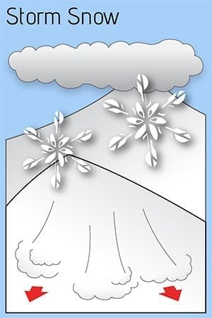
The 2/5-7 storm produced strong E-SE winds along with 1.5-3 feet of new snow. The snowpack will need time to adjust to this added weight and bond with the new snow. Human triggered avalanches will be likely today up to 3 feet in depth.
Storm totals vary depending upon proximity to the coast and elevation. The amount of new snow on its own that we have received is enough to create a slab that could be triggered by a person or machine up to 3 feet in depth. Specific areas will have deeper slabs near ridge lines and in wind channeled terrain due to strong wind loading that occurred during the storm. Expect multiple aspects to be loaded due to changing wind direction and terrain influence upon wind direction. Light additional snowfall is forecasted today with gradual clearing skies. As skies clear north winds are expected to be moderate, which will continue to redistribute the new snow in specific areas,
Test slopes on small steep slopes can be a good way to gauge how well the new snow is bonding to the pre-existing snowpack. However, even if results are good, expect human triggered avalanches to be likely on slopes steeper than 35°. Convex and wind loaded terrain will be the most suspect. Watch for signs of instability such as shooting cracks, collapsing and recent avalanche activity.
Likelihood:
- Almost Certain
- Very Likely
- Likely
- Possible
- Unlikely
Size:
- Historic
- Very Large
- Large
- Small
Trend
- Increasing
- Steady
- Decreasing
Problem 2
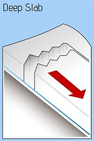
Weak snow continues to exist near the base of our snowpack in all three climate zones. This weak snow has been under increasing pressure as heavy snowfall and strong winds occurred 2/5-7. The last recorded avalanche activity at this layer occurred during the 1/23-25 storm on Nicks Buttress / ~3500’/ north aspect (see avalanche activity section). The amount of snow and wind our area just received was significant, and was a great strength test of weak snow near the base of our snowpack. As skies clear the depth and distribution of natural avalanche activity will give us an idea of the strength of snow near the ground.
Faceted snow near the ground has been found to vary significantly from place to place. In most locations this snow has been found to be rounding (gaining strength) and unreactive in stability tests. In thin areas of the snowpack these facets are significantly more developed. The most likely places to affect weak snow near the ground will be in areas where the snowpack is thin.
If you find it is possible to push a ski pole to the ground in areas you travel. Assume that a weak faceted snowpack exists in that location, that could act as a trigger point.

Depth hoar from Nicks Buttress ~4000′ North aspect 1/31.
Likelihood:
- Almost Certain
- Very Likely
- Likely
- Possible
- Unlikely
Size:
- Historic
- Very Large
- Large
- Small
Trend
- Increasing
- Steady
- Decreasing
Avalanche Activity
Below is a summary of observed Avalanche activity from the last 7 days. Avalanches that were noted earlier in the season can be viewed by clicking the link below.
If you trigger or observe an avalanche consider leaving a public observation.
No avalanches reported or observed in the last 7 days.
Weather
Check out our updated weather tab! A collection of local weather stations are available for viewing with graphs and tabular data included.
NWS Watches and warnings
NONE
NWS Point forecast for Thompson Pass
Date               Wednesday 02/08/23      Thursday 02/09/23
Time (LT)          06    12    18    00    06    12    18    00    06
Cloud Cover        OV    OV    BK    BK    OV    BK    SC    FW    SC
Cloud Cover (%)    85    80    65    65    75    60    25    15    40
Temperature        14    18    17    14    13    14    10     1    -3
Max/Min Temp                   20          12          15          -3
Wind Dir            E    SE    SE    NE    NE    NE    NE    NE     E
Wind (mph)         11     9     8     8    13    16    13    11     5
Wind Gust (mph)          23                26    32    32    27
Precip Prob (%)    80    80    60    10     0     0     0     0     0
Precip Type         S     S     S
12 Hour QPF                  0.06        0.02        0.00        0.00
12 Hour Snow                  1.2         0.1         0.0         0.0
Snow Level (kft)  0.0   0.0   0.0   0.0   0.0   0.0   0.0   0.0   0.0
Click on link below for Thompson Pass weather history graph:

| Date:
02/08 |
24 hr snow | HN24W* | High temp | Low temp | 72 hour SWE* | February snowfall | Seasonal snowfall | Snowpack Depth |
| Valdez | 5 | .36 | 32 | 26 | 1.95 | 36 | 181 | 63 |
| Thompson pass | 5 | N/O | N/O | N/O | N/O | 51 | 340 | 62 |
| 46 mile | N/O | N/O | 27 | 4 | N/O | 13 | ~80** | 48 |
*HN24W- 24 hour Snow water equivalent in inches
*SWE– Snow water equivalent
**46 mile seasonal snowfall total begins December 1st.
Additional Information
Click on the link below for a running summary of the seasons weather history.
Announcements
The avalanche hazard is Considerable at all elevations. All of our forecast zones have received 1.5-3 feet of new snow along with strong winds over the last 48 hours. Our snowpack needs time to adjust to the weight of the new snow. In the meantime, human triggered avalanches are likely up to 3 feet in depth. Cautious route finding and conservative terrain choices, will be essential for safe travel in avalanche terrain.
Posted by Gareth Brown 02/08 8:00 am.
For a description of current avalanche problems, weather information, season history and more click the (+ full forecast) button. Avalanche forecasts will be issued Wednesday-Sunday.
If you have pictures of recent natural or human triggered avalanches or notice signs of instability such as shooting cracks or collapsing, leave an observation to help improve forecast accuracy.

