Valdez
Above 3,000ftNone
1,500 to 3,000ftNone
Below 1,500ftNone
Degrees of Avalanche Danger
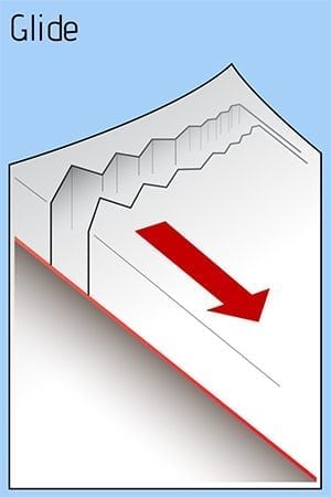
Avalanche Problems
Problem 1

Likelihood:
- Almost Certain
- Very Likely
- Likely
- Possible
- Unlikely
Size:
- Historic
- Very Large
- Large
- Small
Trend
- Increasing
- Steady
- Decreasing
Problem 2
Likelihood:
- Almost Certain
- Very Likely
- Likely
- Possible
- Unlikely
Size:
- Historic
- Very Large
- Large
- Small
Trend
- Increasing
- Steady
- Decreasing
Problem 3
Likelihood:
- Almost Certain
- Very Likely
- Likely
- Possible
- Unlikely
Size:
- Historic
- Very Large
- Large
- Small
Trend
- Increasing
- Steady
- Decreasing
Avalanche Activity
Please share your field observations including signs of stable snow HERE.
Weather
The most recent NWS rec Forecast can be found HERE:
258 PM AKST Sat Mar 2 2019
The Thompson Pass Mountain Forecast covers the mountains (above
1000 ft) surrounding Keystone Canyon through Thompson Pass to
Worthington Glacier.
                   Tonight      Sun

Temp at 1000`      19 F         24-32 F

Temp at 3000`      25 F         24 F

Chance of precip   40%          30%

Precip amount
(above 1000 FT)    0.04 in      0.04 in

Snow amount
(above 1000 FT)    trace        trace

Snow level         sea level    sea level

Wind 3000` ridges  S 0-11 mph   NE 2-12 mph
Additional Information
SNOWPACK BIG PICTURE: Wind slabs from Feb 20-22 (which were up to 3′ thick) have gained significant strength and have began to deteriorate on the surface. Below the recent wind slabs there are multiple layers that are mostly showing good bonding. Of note the Jan 23rd buried surface hoar layer is reactive north of 40 mile; but is still possibly reactive in isolated pockets in steep, cold, shaded terrain in more maritime zones. The further interior, the problem layers are more widespread and snowpack is considerably shallower.
Recent snowpack history, from top to bottom:
Feb 22-28: Calm high pressure with gradually increasing temps (reaching 40 in town on Feb 28) and only a few hours of moderate north winds. There have been no signs of the persistent weak layer problem outside of snowpits.
Feb 20-22: High N-NE winds, rapidly transporting any available snow (70mph gusts). In certain places the wind built new slabs and alternatively stripped all the new snow back to rain crusts. The current snow surface is sastrugi, wind slab, rain crust, or on low elevation southerly aspects – melt-freeze crust.
Feb 16-18: Over 2″ SWE and 2′ of snow with little wind.
Feb 7-14: Nearly 0″ new snow and building north winds (70mph NE gusts on Feb 14 at Thompson Pass.) Widespread surface hoar growth up to 6mm. In windy locations, and close to the pass, most of this surface hoar has been knocked down. A ‘drizzle crust‘ formed near the pass up to 5500′ and was observed buried 55cm down on Loveland at 5000’ (on Feb 20.)
Feb 3-6: 0.7″ SWE and 8″ of snow from Valdez to Thompson Pass. 8″ of new snow was recorded at 5500′ on Catcher’s Mitt. Freezing level was sea level throughout this cycle.
Jan 30-Feb 1: Natural avalanche cycle on all aspects above 3000′, up to size D3. Most ran on buried surface hoar.
Jan 28-30: 2″ SWE in Valdez, moderate winds, freezing level 1000′.
Jan 23-25: Multiple days of warm and wet with periods of rain up to 2500′.
Jan 13-22: Mostly clear, cold, and dry with light to moderate north winds. Widespread Surface Hoar growth (up to 15mm) and Near Surface Faceting.
Jan 12-13: 3-10″ of new snow with little wind.
Jan 4-12: was VERY cold and dry: moderate winds and wind chill reaching -50F. Pockets of surface hoar and widespread near surface faceting.
Dec 30-Jan 3: The New Year’s Eve storm brought nearly 2.5″ of SWE to Valdez and almost another 1″ (SWE) on the 2-3rd of January. The rain line was 1200′ during the Jan 2-3 storm, forming a 1-3″ crust locking up all the snow beneath it. These storms accumulated over 3′ above 2000′ near Thompson Pass. Both of these storms had little wind.
Above 4000′ the snowpack averages well over 300cm deep and has good strength and structure (few lemons). Below 4000′, the snowpack is significantly shallower and has old problem layers that are bonding well (rounding) and currently dormant: facet-crust combos and BASEL facets (all the way to sea level).
If you get out riding, please send in an observation.
Do a rescue practice with your partners. Always carry a beacon, shovel, and probe, and KNOW HOW TO USE THEM.
Practice good risk management, which means only expose one person at a time to slopes 30 degrees and steeper, make group communication and unanimous decision making a priority, and choose your terrain wisely: eliminating unnecessary exposure and planning out your safe zones and escape routes.
Announcements
There is NO current avalanche hazard rating. The most recent rating in the Maritime region was LOW at all elevations with older and deeper slab avalanches still being possible-but unlikely-in very steep terrain. Each snowpack region has a unique forecast and hazard evaluation. Click FULL FORECAST for the most recent avalanche forecast.
Please share your field observations HERE.