Valdez
Above 4,000ftNone
2,000 to 4,000ftNone
Below 2,000ftNone
Degrees of Avalanche Danger
Avalanche Problems
Problem 1
Likelihood:
- Almost Certain
- Very Likely
- Likely
- Possible
- Unlikely
Size:
- Historic
- Very Large
- Large
- Small
Trend
- Increasing
- Steady
- Decreasing
Problem 2
Likelihood:
- Almost Certain
- Very Likely
- Likely
- Possible
- Unlikely
Size:
- Historic
- Very Large
- Large
- Small
Trend
- Increasing
- Steady
- Decreasing
Avalanche Activity
1 large avalanche was reported on Dec 23rd: a slab avalanche near the ridgeline of RFS, below the cornice. It was reported as possibly a size 2.5, persistent slab that ran 800-1000′.
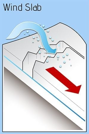
Over the past few days several small wind slabs released near Thompson Pass from human triggers and several more small cornices released naturally, south facing 3-4000′.
Please share your field observations including signs of stable snow HERE.
Weather
The most recent NWS rec Forecast can be found HERE:
402 PM AKST Sun Dec 30 2018
The Thompson Pass Mountain Forecast covers the mountains (above
1000 ft) surrounding Keystone Canyon through Thompson Pass to
Worthington Glacier.
   Tonight      Mon

Temp at 1000`      29 F         32 F

Temp at 3000`      29 F         32 F

Chance of precip   100%         100%

Precip amount
(above 1000 FT)    0.93 in      0.48 in

Snow amount
(above 1000 FT)    6-14 in      4-8 in

Snow level         sea level    400 ft

Wind 3000` ridges  E 10-30 mph  SW 20-40 mph

Remarks...None.
Additional Information
BIG PICTURE: The snowpack has been settling since the last major round of storms that ended Dec 19th. Since 12-19 there has been 6″ of snow in Valdez with 1″ SWE; 7″ of snow on Thompson with 0.5″ SWE and a trace at 46mile. Above 4000′ the snowpack averages over 300cm deep and has good strength and structure (few lemons). Below the rain line from the historically warm and wet October, 3500-4000′, the snowpack is significantly shallower and has more problem layers: facet-crust combos and basel facets (all the way to sea level). There is barely enough snow to build a slab avalanche or travel off trail anywhere below 1500′.
TREND NYE through Jan 3, 2019:
NWS is forecasting several days of warm, wet and possibly windy storm days this next week. New snow will likely form NEW storm slabs and wind slabs. If enough moisture falls then older weak layers that are currently dormant could awaken and release PERSISTENT SLABS with significant avalanches up to size D3. If we get rain on snow then small wet avalanches will also be possible. The next forecast will be Friday Jan 4th.
If you get out riding, please send in an observation!
Do a rescue practice with your partners. Always carry a beacon, shovel, and probe, and KNOW HOW TO USE THEM.
Practice good risk management, which means only expose one person at a time to slopes 30 degrees and steeper, make group communication and unanimous decision making a priority, and choose your terrain wisely: eliminating unnecessary exposure and planning out your safe zones and escape routes.
Alerts
There is NO current HAZARD RATING, the most recent avalanche problem information is in the full forecast; however the type of avalanche problem is changing with the current warm, windy, and wet storm. CAUTION: new storm slabs, wet avalanches, dry loose avalanches and awakening persistent slabs are all likely at different elevations within the Valdez region. All 3 zones have the same forecast. Have a safe New Years and all the best in 2019 from your community supported Valdez Avalanche Center.


