Valdez
Above 3,000ftModerate
1,500 to 3,000ftLow
Below 1,500ftLow
Degrees of Avalanche Danger
Avalanche Problems
Problem 1

Likelihood:
- Almost Certain
- Very Likely
- Likely
- Possible
- Unlikely
Size:
- Historic
- Very Large
- Large
- Small
Trend
- Increasing
- Steady
- Decreasing
Problem 2

Likelihood:
- Almost Certain
- Very Likely
- Likely
- Possible
- Unlikely
Size:
- Historic
- Very Large
- Large
- Small
Trend
- Increasing
- Steady
- Decreasing
Problem 3
Likelihood:
- Almost Certain
- Very Likely
- Likely
- Possible
- Unlikely
Size:
- Historic
- Very Large
- Large
- Small
Trend
- Increasing
- Steady
- Decreasing
Avalanche Activity
12/10-The only new natural avalanche activity in the Thompson Pass corridor was small, wet point-releases off the Nicks and Python Buttresses. These originated from 3500-4000′ and did not entrain more snow.
Public observers witnessed natural avalanches on the Valdez Glacier Lake, Hogsback Ridge and wet slide avalanche activity in the ice climbing areas of Keystone Canyon, Sheep Creek, Bear Creek, and Mineral Creek.
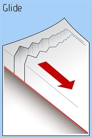
The avalanche near Valdez Glacier Lake was a glide crack release off a SW aspect of peak 4690′ above the Valdez Glacier Lake. The debris reportedly ran all the way to the lake, with the deposition pile only feet away from a well used cross country ski trail.
Weather
Temperatures continued to drop through the night of 12/11 and are now in the high teens at Thompson Pass and low 20’s for valley locations such as the Tsaina and 46 mile. At 7 am, the temperature was 32 F at sea level. Expect mostly cloudy conditions today, with light to moderate winds out of the NE. Winds will be stronger in channeled terrain such as “the gap” at Thompson Pass. We should see light flurries today and tonight, though little to no snow accumulation is expected.
The Thompson Pass Mountain Forecast covers the mountains (above
1000 ft) surrounding Keystone Canyon through Thompson Pass to
Worthington Glacier.

This forecast is for use in snow safety activities and emergency
management.

                   Today        Tonight

Temp at 1000`      33 F         29 F

Temp at 3000`      23-30 F      30 F

Chance of precip   70%          90%

Precip amount
(above 1000 FT)    0.04 in      0.05 in

Snow amount
(above 1000 FT)    0 in         0-1 in

Snow level         400 ft       400 ft

Wind 3000` ridges  NE 10-28 mph NE 10-27 mph

Remarks...None.
| 24h snowfall (inches) | HN24W (inches)* | Hi Temp (F) | Low Temp (F) | Dec snowfall | Season Snowfall | |
| Valdez | 0 | 0 | 36 | 26 | 7 | 31 |
| 46 mile | 0 | 0 | 25 | 21 | – | – |
|
Nicks snotel (4500′) |
0 | 0 | 32 | 29 | – | – |
HN24W= total water received last 24 hours in inches
Additional Information
Winds have shifted from onshore S/SE to offshore N/NE within the last 24 hours. This switch in wind direction will begin to load South facing slopes below ridge lines with fresh wind slab. Yesterday found 2 feet of 4-finger density windslab forming in specific locations. This new slab was cracking underfoot which is a sign that it has energy to slide and will need time to strengthen. Look for these slabs to grow in size if winds become stronger than forecasted. Flagging on peaks and ridges will be a sure sign that windslab is building. In places that were unaffected by the wind, the new snow from 12/6-10 is bonding well to the old snow interface.
Rain runnels were apparent in the snow below 2500′. With temperatures falling below freezing, the snowpack will begin to lock up and gain strength. Below 3000′ there is a pencil hard rain crust. Above this, the snow is more dry and the 12/9-10 storm has consolidated to about 1′ deep. Storms from the last week were very warm and fell upon drier, colder snow. If you venture into avalanche terrain today, use terrain progression as a tool. Start with small slopes that have no consequence, before committing to larger slopes.
Human triggered avalanches are possible today in the upper elevations. Avoid wind loaded slopes above 32°. Windslab will often have a hollow, drum-like feel. Stay away from slopes that are actively being loaded. Also watch out for cornices that have likely grown in size over the last few days and will be adjusting to their new weight.
Below 2500′ where you find a rain crust the avalanche hazard is low. Freezing temperatures have locked up the snowpack helped it to gain strength.
The hazard will SLOWLY decrease as temperatures cool off. The snowpack will need time to adjust to its new load. Be patient, and avoid cross-loaded gullies, avalanche paths, and terrain traps. Careful decision making and route finding will be necessary.
If you travel into the upper elevations today, please leave a public observation. The more info we can get from various locations will help us to get a clearer picture of the snowpack in our beautiful Valdez Chugach!
Forecast Confidence is moderate.
Announcements
The avalanche hazard is moderate at upper elevations. Natural avalanches are unlikely today unless caused by a glide crack. Skier triggered avalanches are possible today on terrain that has been recently or is actively being loaded by moderate North winds. Good indicators for windslab are a rapid increase in depth of the new snow over a short distance, shooting cracks and a hollow, drum-like feel. Use caution in the mountains today, watch for windslab and avoid terrain traps.