Valdez
Above 4,000ftNone
2,000 to 4,000ftNone
Below 2,000ftNone
Degrees of Avalanche Danger
Avalanche Problems
Problem 1
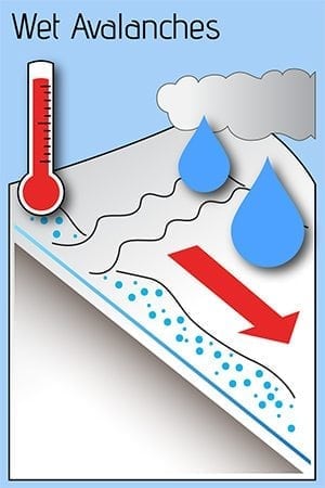
Continued warm and wet weather will continue through the weekend creating a high likelihood for wet loose avalanches below 2500′ in terrain steeper than 35°. Freezing lines are forecasted to return to near sea level by Monday morning which will lower the likelihood and sensitivity of this problem.
Likelihood:
- Almost Certain
- Very Likely
- Likely
- Possible
- Unlikely
Size:
- Historic
- Very Large
- Large
- Small
Trend
- Increasing
- Steady
- Decreasing
Problem 2
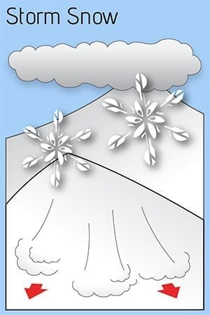
Steady snowfall along with periods of moderate to strong winds are allowing storm slabs to build at upper elevations. The depth and sensitivity of these storm slabs is currently unknown. Use extra caution during periods of heavy precipitation and when signs of instability such as shooting cracks and/or collapsing are present.
Likelihood:
- Almost Certain
- Very Likely
- Likely
- Possible
- Unlikely
Size:
- Historic
- Very Large
- Large
- Small
Trend
- Increasing
- Steady
- Decreasing
Weather
NOAA Thompson Pass pt fx (2700′):
Northeast Prince William Sound-
Including the cities of Valdez and Thompson Pass
135 PM AKST Sat Nov 25 2023

...PERIODS OF HEAVY RAIN ON SNOW EXPECTED FOR VALDEZ THROUGH
SUNDAY...

An approaching warm front and associated atmospheric river will
bring heavy rainfall to Valdez. One to two inches of rain is
expected for Valdez from Saturday through Sunday night before a
transition to snow by Monday morning. Heavy rain on snowpack may
result in ponding water on roadways. Additionally, rain falling on
frozen or snowpacked roads may lead to slick driving conditions.

Detailed weather forecast for Thompson Pass (2k-4k):
Date                     Sunday 11/26/23         Monday 11/27/23
Time (LT)          03    09    15    21    03    09    15    21    03
Cloud Cover              OV    OV    OV    OV    OV    OV    OV    SC
Cloud Cover (%)         100   100    90   100   100   100    85    45
Temperature              30    32    30    30    28    27    25    23
Max/Min Temp                   32          28          31          20
Wind Dir                 SE     S     S    SE    SE     S    SW    SW
Wind (mph)               20    18    13    14    17    17    13    11
Wind Gust (mph)          47    34    28    37    43    36    28    27
Precip Prob (%)   100   100   100    80   100   100    90    80    30
Precip Type               S     S     S     S     S     S     S     S
6 Hour QPF             0.24  0.17  0.15  0.15  0.20  0.18  0.13  0.03
6 Hour Snow             2.5   1.7   1.5   1.6   2.1   2.0   1.6   0.3
Snow Level (kft)        2.9   2.2   1.6   1.7   1.4   0.5   0.3   0.2
Additional Information
On 11/25 the snowpack below 2500′ on the north side of Thompson Pass was found to be rain saturated with an average depth of 3′ at 2000′. Above 2500′, moist snow existed in the top 1 ‘ , but drier snow existed beneath with no major red flags in structure and no unstable results in stability tests. There is currently not a lot of data from the alpine snowpack. The sensitivity of storm slabs as well as the presence of potential persistent weak layers is unclear at this point.
Once freezing lines return to sea level by 11/27 and a solid refreeze occurs we will be left with a strong base at lower elevations. Snowpack depths will continue to build at upper elevations during the next week as continued light to moderate snow looks likely. A slowly building snowpack along with warm temperatures will help to encourage the snow to gain strength in the medium/long term. In the short term as the snowpack builds, be aware that periods of elevated hazard will likely occur during periods of intense precipitation, and/or wind. Watch for signs of instability such as shooting cracks, collapsing and recent natural avalanche activity that indicate unstable conditions.
Announcements
November Early Season update 11/26
Welcome to a new winter! Regular VAC forecasts will begin December 1st.
Until then, please share your observations to bolster our understanding of how the early snowpack is developing.
Warm and wet conditions continue for the Valdez/Thompson Pass area. Freezing lines rose to 4000′ on Thanksgiving and have been slowly descending to about 2500′ as of 11/26 at 7 am. This weather has increased the likelihood for wet loose avalanches below 2500′ in steep terrain. Storm slabs and snowpack depth are slowly building above 4000′. The freezing line is forecasted to continue to drop to at or near sea level by Monday morning. Valdez should see rain switch to snow as early as Sunday evening. This will lower the likelihood for wet loose avalanches although storm slabs will continue to build at upper elevations. As stated above storm slab sensitivity is unclear at this point but expect for sensitivity to increase during times of heavy precipitation.


