Valdez
Above 4,000ftHigh
2,000 to 4,000ftHigh
Below 2,000ftHigh
Degrees of Avalanche Danger
Avalanche Problems
Problem 1
Likelihood:
- Almost Certain
- Very Likely
- Likely
- Possible
- Unlikely
Size:
- Historic
- Very Large
- Large
- Small
Trend
- Increasing
- Steady
- Decreasing
Problem 2
Likelihood:
- Almost Certain
- Very Likely
- Likely
- Possible
- Unlikely
Size:
- Historic
- Very Large
- Large
- Small
Trend
- Increasing
- Steady
- Decreasing
Avalanche Activity
12/28- Several natural avalanches reported in the 54 mile area near brush line. 100′ wide and ran 300′. Depth was not observed.
12/26- Skier triggered avalanche on Cracked Ice Buttress: N aspect, 2500′, 37° slope, 18 inches deep, 100 feet wide, ran 200-300 feet. SS-ASu-D1-R1-I
12/24- Skier triggered avalanche on Python Buttress: NW aspect, 2700′, 35° slope, 60 feet wide, ran 200-300 feet. SS-ASu-D1.5-R1-O
12/18- A large glide release was reported off Snowslide Gulch middle peak size 2.5.
12/15- Observed small natural avalanche on west aspect of Goodwills. Released below a cliff band at the bottom of a slope, 100′ wide. SS-N-D1-N
12/8- An observer witnessed a glide crack avalanche. SW aspect of peak 4690′ above the Valdez Glacier Lake. The debris reportedly ran all the way to the lake, with the deposition pile only feet away from a well used cross country ski trail.
Weather
12/30: Warm, moisture laden air is being pumped into our area from the subtropics. Precipitation is expected to continue and freezing line is forecasted to rise to 2000′ by tonight. 1.5 ” of additional water is expected, which could add up to 12-18 inches more snow above rain line. Winds are forecasted to be light to moderate, out of the south.
The Thompson Pass Mountain Forecast covers the mountains (above
1000 ft) surrounding Keystone Canyon through Thompson Pass to
Worthington Glacier.

This forecast is for use in snow safety activities and emergency
management.

                   Today        Tonight

Temp at 1000`      37 F         33 F

Temp at 3000`      31 F         29 F

Chance of precip   100%         100%

Precip amount
(above 1000 FT)    0.63 in      0.80 in

Snow amount
(above 1000 FT)    0-8 in       0-10 in

Snow level         1600 ft      1900 ft

Wind 3000` ridges  S 1-14 mph   S 2-12 mph
| 24h snowfall (inches) | HN24W (inches)* | Hi Temp (F) | Low Temp (F) | Dec snowfall | Season Snowfall | Snow height | |
| Valdez | 6 “rain on snow” | 1.21 | 32 | 27 | 53 | 70 | 36 |
| 46 mile | 4 “rain on snow” | .55 | 36 | 3 | – | – | 20 |
|
Thompson Pass “DOT” |
27″ | – | 28 | 23 | – | – | 96″ |
HN24W= total water received last 24 hours in inches
Additional Information
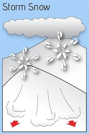
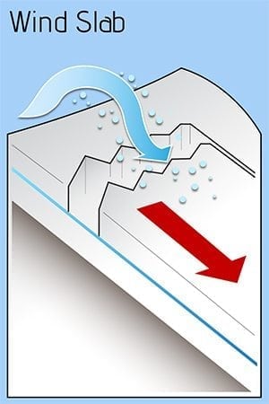
We are developing the perfect recipe for avalanches: a bed surface, a weak layer, a slab and increasing temperatures. The 12/9 rain crust will act as our bed surface. Above the rain crust is our weak layer, a 5 cm layer of facets that has been created by the recent cold weather. Third is our slab, which has been created by snowfall that started 12/22 and is approaching 6′ at Thompson Pass. This slab is growing in size with continued heavy snow. Temperatures rose significantly 12/29 and precipitation type has turned from snow to rain below 1000′. Above 1000′, the snow has become heavier, which will create instability within the storm snow. Human triggered and natural avalanches that happen within the upper snowpack could step down into lower layers and create very large avalanches. Hazard will remain High until temperatures cool and significant snowfall stops.
There have been limited observations from interior locations due to low snow at lower elevations. Use caution if you travel in these areas.
If you have traveled in the mountains, please leave a public observation. The more info we can get from various locations will help us to get a clearer picture of the snowpack in our beautiful Valdez Chugach!
Forecast Confidence is High.
Video taken 12/20 in the Mt. Dimond area showing reactive test slopes. https://vimeo.com/user106668057/review/380916811/02da5d1cc7
Alerts
The avalanche hazard is High today at all elevations on all aspects. Natural avalanches are likely and human triggered avalanches are very likely. Thompson Pass continues to receive significant snowfall, with 27 inches having fallen in the past 24 hours. Temperatures spiked on 12/29 creating dangerous avalanche conditions. Avoid travel in avalanche terrain today. Stay clear of avalanche runout zones. The hazard will remain high until temperatures fall and precipitation tapers.


