Hatcher Pass
Above 3,500ft None
2,500 to 3,500ft None
Below 2,500ftNone
Degrees of Avalanche Danger
Avalanche Activity
The last human-triggered avalanches occurred Tuesday March 12th. These included several small and large storm slab avalanches, wind slabs, loose dry avalanches, two cornice triggered avalanches, and a wet loose avalanche. The last natural avalanches observed occurred Tuesday March 12th, including several long running wet loose and loose dry avalanches on slopes steeper than 40 degrees. There were also several human-triggered and natural wind slab avalanches reported during the wind event on March 9 and 10 including a large wind slab human-triggered avalanche on a N aspect of Hatch Peak above $1000 run reported March 10.
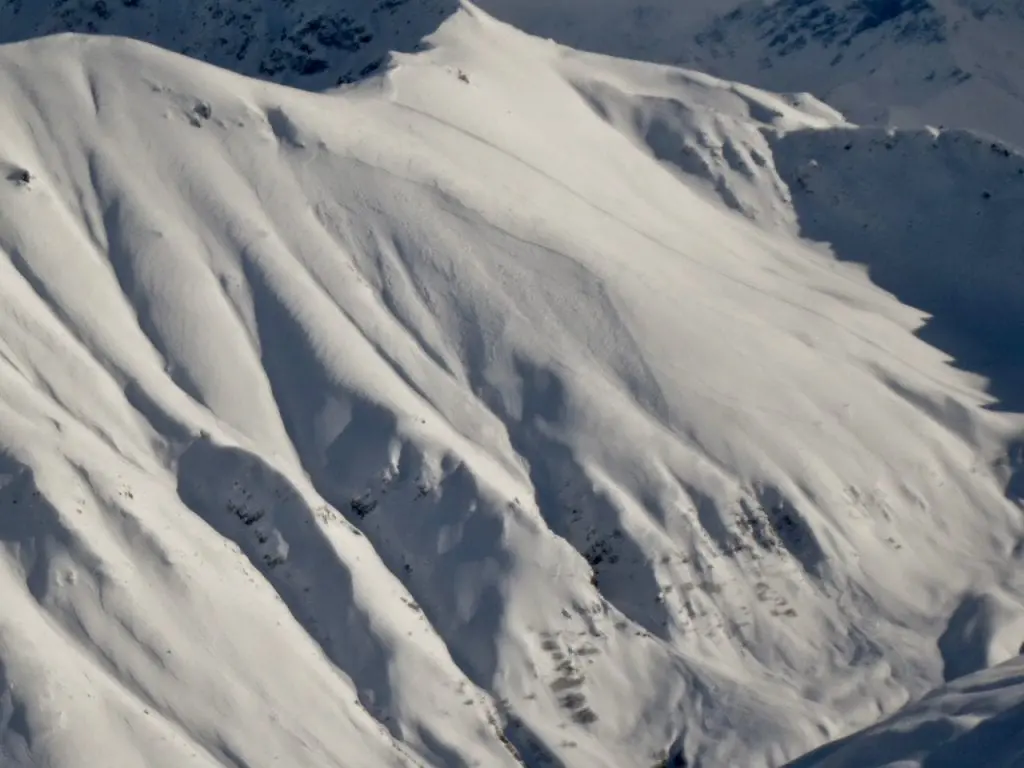
Above: 2 larger (D1.5 to D2) slab avalanches, 3500′, estimated 6-12″ deep on NW aspect of Arkose (Punk Spines, due N of Stairstep), one of which looked to have sympathetically triggered another small slab avalanche below.
 4
4
Above: Several small (D1) soft storm slab avalanches, 4500′, 6-12 inches deep, on steep SW to W aspects of spines of Rae Wallace Chutes
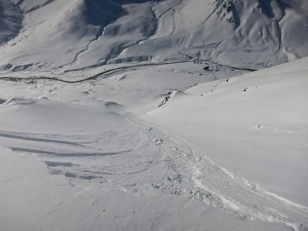
Above: Cornice-triggered loose dry avalanche on SW aspect of Marmot at 4300′.

Above: Cornices have grown quite large along Marmot ridgeline and were sensitive to trigger on March 12. This cornice was easily triggered resulting in a long running loose dry avalanche on the SW aspect of Marmot at 4300′.
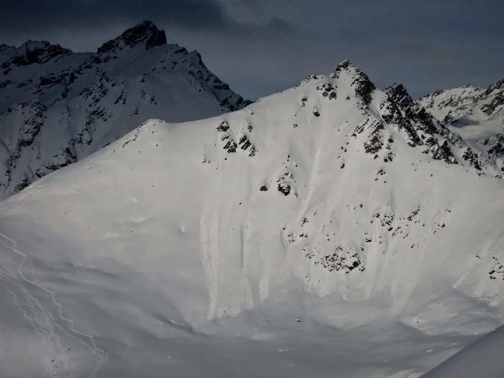
Above: Numerous long-running dry loose natural avalanches off steep (>40 degrees) S aspect of Microdot at 4600′.
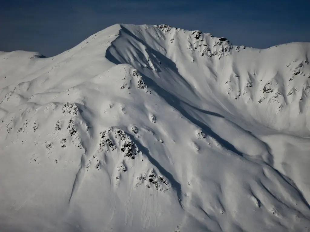
Above: Long running loose dry avalanche on NE/E aspect of Skyscraper, 4500′, that ran from ridge into Eldorado Bowl about 700 ft.

Above: 100′ wide propagating human-triggered small (D1) wind slab avalanche on NE aspect of Lower Eldorado Bowl test slope at 3200′. 6-16″ deep soft slab. Observed on March 9th during wind event.
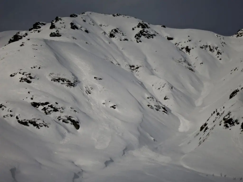
Above: Natural wind slab avalanches in NE aspect of cross-loaded Martin Mine Gully at 4000′ that is believed to have occurred overnight on March 8 during the wind event.
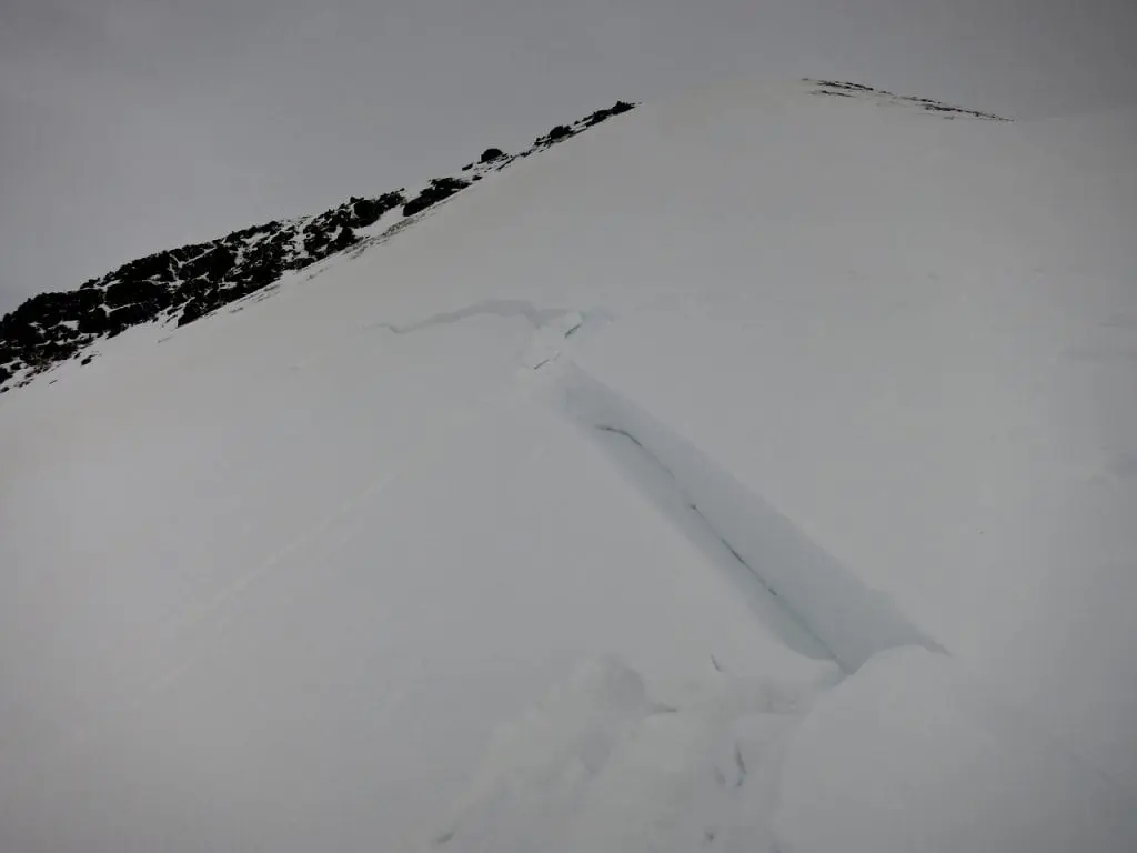
Above:Wind slab in W side of Hatcher Pass at 3900′ reported on March 9 during wind event.

Above: Natural wind slab that stepped down into buried persistent weak layers and failed at the ground in April Bowl at 4500′ on W aspect. Reported on March 10 during the wind event. This path is a repeat offender and has avalanched many times this season.
Weather
Weather History
Weather at 3450′ since Saturday 3/9:
Temperatures averaged 26°F, with a low of 13°F and a high of 3°F.
Winds averaged S 4 mph, max 13 mph. Max gusts recorded were S 30 mph .
There has been 13″ new snow recorded at Independence Mine since 3/9.
Weather at 4500′ since Saturday 3/9:
Temperatures averaged 19°F, with a low of 10°F and a high of 23°F.
Winds averaged ESE 11 mph, max 24 mph. Gusts averaged ESE 18 mph, max gust 39 mph.
Forecast Weather
Stay tuned to the NOAA point forecast for an updated weather forecast each day. The best way to see if it’s snowing in Hatcher Pass is to look at the webcam snow stake HERE and the Independence Mine SNOTEL site HERE
State Parks Snow Report and Motorized Access information can be found here.
Announcements
Get the full HPAC summary HERE for Thursday, March 14, 2019.
This information is a Conditions Update. Danger ratings are only issued with avalanches advisories. The next avalanche advisory is scheduled for Saturday March 16, 2019.
Previous avalanche advisories HERE
MIDWEEK SNOW AND AVALANCHE CONDITIONS SUMMARY
Moderate to strong E to ESE winds yesterday afternoon and overnight have picked up 6-9″ of low density snow that fell Monday March 11th and transported it to leeward aspects forming fresh wind slabs 6″ to 16″ thick. Human-triggered wind slab avalanches will be likely and natural avalanches will be possible in leeward and cross-loaded terrain, on predominantly W to N aspects, in mid and upper elevations. It may be possible, but is generally unlikely, for a wind slab avalanche to step down to buried persistent weak layers, triggering an avalanche up to 2′ thick at mid and upper elevations. Human-triggered avalanches will be unlikely at lower elevations. Careful snowpack evaluation, cautious route-finding, and conservative decision-making will be essential while we give the snowpack time to adjust to the new load.
Numerous human-triggered avalanches occurred on Tuesday March 12, including:
- Two large (D2) wind slab avalanches on a NW aspect of the Punk Spines on Arkose Ridge
- Four small (D1) storm slab avalanches on SW to W aspects of spines in the Rae Wallace Chutes
- Two cornice triggered avalanches triggering long-running loose dry avalanches on Marmot
- Several long-running loose dry avalanches in Rae Wallace Chutes and on the SW aspect of Marmot
- A long running wet loose on the SW aspect of Marmot.
Several natural loose dry and wet loose avalanches were observed Tuesday March 12 across Hatcher Pass.
Hatcher Pass received 4″ new snow (0.24″ SWE) over the weekend, another 9″ snow (0.6″) SWE Monday March 11th, and trace snow Tuesday March 12th overnight. The 4″ of snow falling over the weekend fell during moderate to strong winds. The 9″ of low-density snow that fell Monday March 11th blanketed the landscape nicely, falling under light gusting to moderate winds. This low density snow has since been redistributed across Hatcher Pass due to E to ESE moderate to strong winds overnight.