Haines Avalanche Center
Above 2,500ftNone
1,500 to 2,500ftNone
Below 1,500ftNone
Degrees of Avalanche Danger
Avalanche Problems
Problem 1
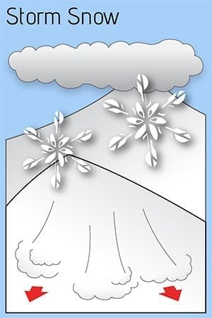
Avalanche season is here! You can expect any fresh storm slabs to be tender in steep terrain, with slab avalanches possible anywhere there is a cohesive fresh layer sitting over a density interface within the new snow, or on old firn from Summer. Rocks will be a major safety hazard as well, so take it slow and easy, and keep your avalanche eyeballs on, especially in wind loaded areas and convexities!
Photo from 10/22 showing 6-12″ of snow above 3500ft (credit Tim Thomas). This was before the storm that arrived 10/26. See the Weather section below for more details.
Likelihood:
- Almost Certain
- Very Likely
- Likely
- Possible
- Unlikely
Size:
- Historic
- Very Large
- Large
- Small
Trend
- Increasing
- Steady
- Decreasing
Avalanche Activity
We haven’t had any avalanches reported yet this season. If you observe any avalanche activity, please submit an observation!
Weather
Forecast:
Colder weather has finally arrived, bringing snow levels down to 1500ft, and occasionally down to near sea level. Storminess looks to continue through Halloween, with snow levels near (or just above) sea level and 12-24″ of new snow over the mountains over a 4 day period. The models are showing signs of our first cold air outbreak starting around Nov. 1st.
Seasonal Summary:
- October 26-27th brought in 5-12″ of heavy wet snow above 1500ft
- The first layer of snow to remain into winter fell above 3,500ft on Oct 21st. It was 6-12″ deep.
| Snow Depth [in] | Last 24-hr Snow/SWE [in] | Last 3-days Snow/SWE [in] | Today’s Freezing Level [ft] | Today’s Winds | Next 24-hr Snow/SWE | |
| Mount Ripinsky @ 2,500′ | 5″ | 5″ / 0.80″* | 5″ / 0.80″* | 2000′ | Mod, S | 8″ / 0.80″* |
| Flower Mountain @ 2,500′ | 6″ | 6″ / 0.60″ | 6″ / 0.60″ | 1500′ | light, NW | 5″ / 0.50″” |
| Chilkat Pass @ 3,100ft | 5″ | 5″ / 0.33” | 5″ / 0.33” | 1500′ | light, NW | 3″ / 0.30″‘ |
( *star means meteorological estimate )
Additional Information
It’s time to start thinking avalanche. Dust off your gear and make sure it is fully functional. Put new batteries in your beacons! Do a beacon practice to start the season and keep your skills fresh.
If you head into the hills, watch out for avalanche prone areas, and be especially careful of rocks and hidden hazards like crevasses beneath the snow. WEAR A HELMET!
Announcements
We have begun periodic conditions updates for winter 2022/2023. Click the Full Forecast link below to read more.

