Haines Avalanche Center
Above 2,500ftModerate
1,500 to 2,500ftModerate
Below 1,500ftLow
Degrees of Avalanche Danger
Avalanche Problems
Problem 1
The Bottom Line:
10-15″ of new snow fell this week in the Lutak zone. Winds were mostly light, but in the most exposed parts of the alpine there was likely enough wind to create areas of recent wind slab. Test results from Thursday found the new snow is reactive and poorly bonded near treeline. You may find areas of sensitive wind slab on any wind-affected slopes. Any strong solar radiation will make these surface wind slabs more likely to trigger. Avoid any steep, wind loaded slopes especially near cliffs or terrain traps.
- Be on the lookout for reactive wind slabs, especially on exposed alpine slopes and beneath ridgelines.
- Blowing snow and cracking or collapsing in drifted snow are clear warning signs of the problem.
- Sticking to sheltered or wind-scoured areas can help avoid wind slabs. Also, fresh new loose snow could sluff and carry a rider over cliffs, and rocks or into a terrain trap.
- Manage your terrain appropriately and verify conditions as you travel.
Practice good group management, communication and decision making.
- Do not ski/ride on the same slope as another person/group.
- Travel one at a time or with enough spacing so that only one person is exposed to an avalanche path.
- Always keep eyes on exposed riding partners.
Continue to keep wide margins with cornices- Respect the power and trouble they can cause. They often break much further back than expected.

Likelihood:
- Almost Certain
- Very Likely
- Likely
- Possible
- Unlikely
Size:
- Historic
- Very Large
- Large
- Small
Trend
- Increasing
- Steady
- Decreasing
Problem 2
Unlikely to trigger but high consequence deep slab hazards remain in our snowpack. These weak layers are slowly healing, but smaller slides could possibly step down and wake this sleeping dragon. Especially in steep, complex, or rocky terrain.
As spring continues and freeze-thaw conditions start to settle the snowpack, it will be tempting to step out towards some of the bigger objectives. But you should be asking yourself, is this really the snowpack you want to be stepping out onto? Poor structure remains in many areas, with deep persistent weak layers that have occasionally produced large, destructive avalanches over the last few months. As the snowpack warms up, some of these deep layers will come back to life.
There’s nothing wrong with pushing back plans for big spring descents to next year. For some of us, we have decided this is *not* the year to push it, given lingering deep layers that will be waking up again as the weather warms.
Layers still providing poor structure in specific areas:
- Facets below Jan 25 melt-freeze crust ~4-6ft (widespread, up to 4,000 ft)
- Feb 22nd buried surface hoar layer down ~3-5ft.
- Jan 10th buried surface hoar.
- At or near the ground are large, rotten facets– not to be forgotten about.
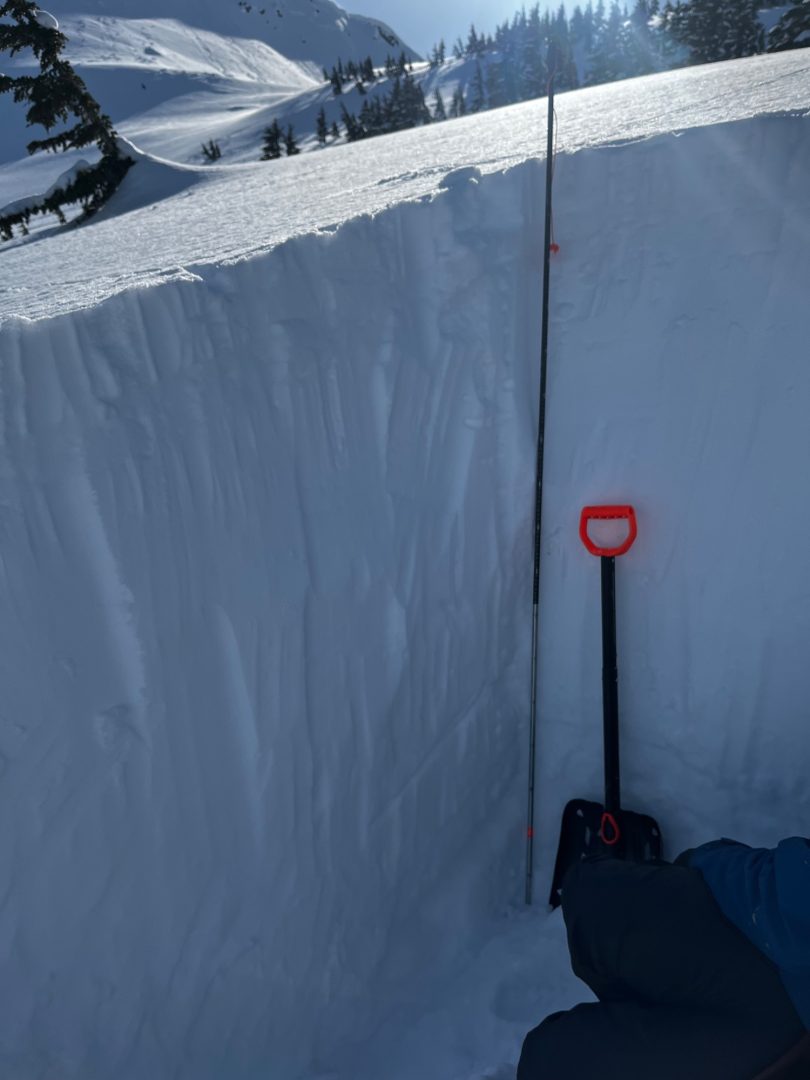
Lutak, March 26th, NE aspect 2675′- Snow pit revels weak snow down 150cm below the Jan 25th crust.


Likelihood:
- Almost Certain
- Very Likely
- Likely
- Possible
- Unlikely
Size:
- Historic
- Very Large
- Large
- Small
Trend
- Increasing
- Steady
- Decreasing
Avalanche Activity
April 1: Multiple D2 soft slabs on cross loaded east aspects above Rainy Hollow.
March 24: D2 Wet loose slides on numerous solar aspects around rocks/shallow areas all elevations
March 19-23: D1-2 Numerous recent wind slabs from south winds last week above treeline Rainy Hollow and Haines Pass
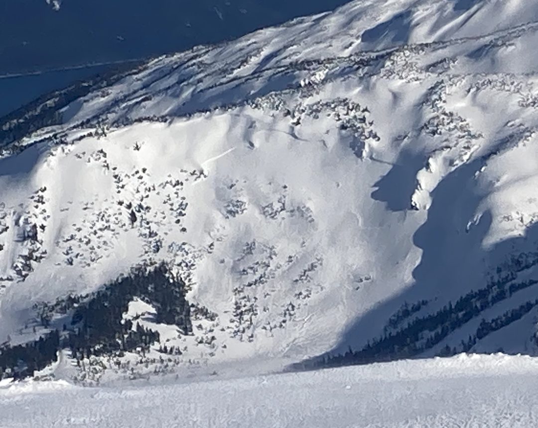
D3 N-aspect 4600′ Buns of steal near Jarvis transitional zone wide propagation (click to enlarge)
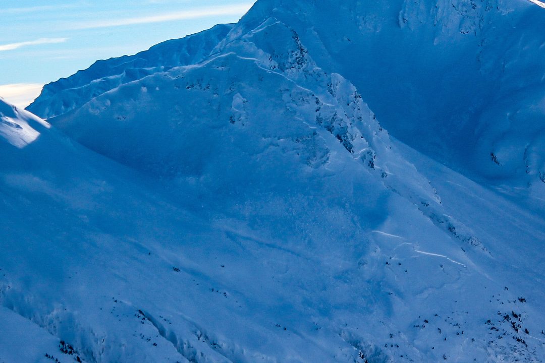
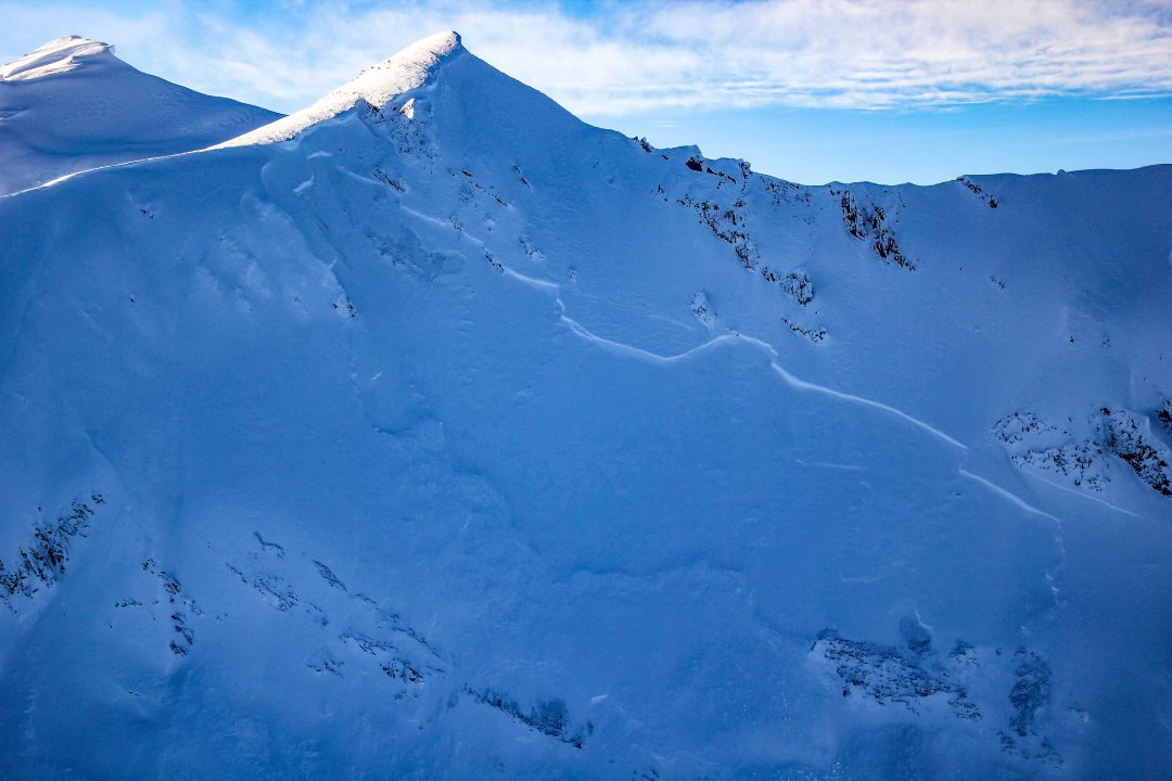
D3 NW-aspect ridgeline below Shakuseyi Peak in the lutak zone
Behind old faithful, D2 cross loaded NE aspect, stepped down 2ft deep. Multiple natural D2 wet/dry slides in cross loaded middle elevation slopes near town and in transitional zone.
March 16: Multiple D2 crowns in cross-loaded gullies 1-meter deep on SW-aspect near 3000ft observed in Lutak Zone.
March 7-9: Multiple D2 natural wind slab avalanches in top 45cm, on wind loaded SW, S, SE aspects in the Transitional zone, 3000-4000ft.
March 4-5: Human triggered wind slab D1/D2 at 5-mile creek Chilkat Pass, 2200ft, W aspect
D2-R4 hard slab: Mid-slope propagation, E aspect, in steep wind loaded area, unsupported slope.
D2-R4 New Faithful, W aspect, high alpine
March 2: Small natural soft slabs were observed in steep trees in the Lutak zone. This kind of small to large natural activity is likely widespread in the Lutak zone.
Feb 19-23: 6 different observations of natural avalanches in the transitional zone and in the Chilkat range. The natural D2 slides were on all aspects, a few on lower angle, all running on a mid-snow pack layer, and a majority with widespread propagation.
A larger, D3-R4 natural avalanche was observed near Four Winds on a S, SW aspect, down 60-120cm, it looked like a loose wet slide that maybe stepped down to a lower layer. Widespread propagation.
Feb 9: Glide cracks ~3000-3400′ in the transitional zone on N, NE aspects. Also notable was observation of reloading of bed surfaces on previous slides.
Jan 28: Two D2’s in the Glory Hole. NW-aspect around 3,200′
Jan 25-29th Multiple wide propagating natural slides released.
Weather
Forecast:
Saturday is looking mostly cloudy with light winds, and precipitation developing in the evening. Snow levels 1,200 to 1,700ft. Expect 3-5″ of snow above 1500ft Saturday night, and another 2-5″ Sunday, with strong SE winds developing Sunday afternoon.
Recent Weather Summary:
- April 1-7: About 0.5 – 1.5″ of precipitation fell, with snow levels near 1000ft.
- March 26th we had a moderate-strong NW wind event, otherwise diurnal freeze-thaw and light winds for several days in late March
- March 19-23 brought light precip. with freezing levels around 2000ft and strong south winds
- March 15-16: 2-4 feet of new snow, strong south winds, and warming temperatures, snow levels reached about 2000ft.
- March 4-7 strong NW / N outflow event with cooling temps.
- March 1st brought a strong and cold storm, with 10-15″ of new snow inland, and 30″+ in the Lutak zone.
- Late Feb 20-Feb 23 a cold high pressure system with moderate to strong N, NW winds
- Feb 19-Feb 20- warmer, solar effect on south aspects, valley fog on the 19th at ~1500-2000 ft.
- Feb 12 freezing levels 1250ft
- Incremental snow (more in Lutak zone) since Feb 5th, periods of moderate S/SE winds
- Feb 1-4 Near surface facets on top of crust from Jan 25 warm-up
- Jan 17-26 brought around 5″ of precip (3-5feet of new snow above 3000ft), strong SE winds, and a noticeable warmup
- Surface Hoar and Near Surface Facet growth Jan 8-10
- A strong front brought 24-30″ of snow above 2000ft on Jan 2nd.
- There was widespread Surface Hoar growth on Dec 31st.
- Complete Season Histories: Transitional Zone Lutak Zone
| Snow Depth | Last 24-hr Snow/SWE | Last 3-days Snow/SWE | Today’s Freezing Level | Today’s Winds | Next 24-hr Snow/SWE | |
| Mount Ripinsky @ 2,500′ | 175″ | 0″ / 0.00″ | 13″ / 1.10″ | 1700′ | light, var | 5″ / 0.40″ |
| Flower Mountain @ 2,500′ | 71″ | 0″ / 0.00″ | 5″ / 0.40″ | 1500′ | light, var | 3″ / 0.30″ |
| Chilkat Pass @ 3,100ft | 49″ | 0″ / 0.00″ | 3″ / 0.20″ | 1500′ | light, var | 3″ / 0.30″ |
Additional Information
WEAR A HELMET! Be careful of rocks and hidden hazards. Be prepared for crevasses when on a glacier.
Are your riding companions trained and practiced in avalanche rescue? Everyone in your group needs to have a beacon, shovel, and probe, and know how to use them. Our mountains have very limited cell coverage, carry an emergency communication device and enough gear to spend the night.

Avalanche Canada’s Daily Process Flow – Utilize this every day you go out in the mountains.
Announcements
Click the +Full Forecast link below for each zone to read more. If you see any recent natural avalanche activity, or signs of instability please submit an observation. Each observation or center membership gets you entered to win prizes for the Support Raffle.